For Sale
$10,000
Est. $56/mo157 St. E and U-8, Palmdale, CA 93591
bed
Bedrooms
bathtub
0
Bathrooms
square_foot
0
Square Feet
About this home
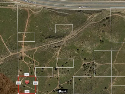
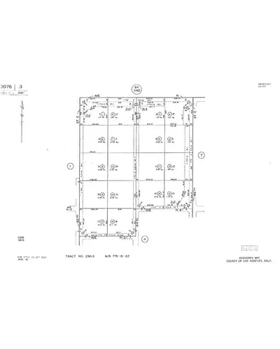
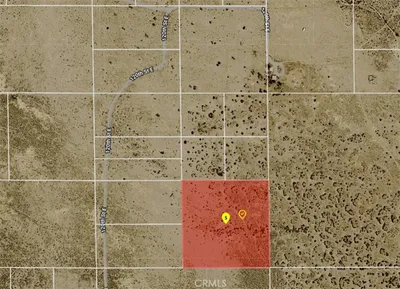
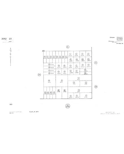
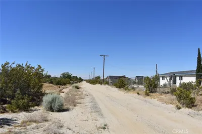
This flat 4.91acres, investment parcel, APN# 3080-025-034 is located in the unincorporated area of northeast Los Angeles County. Zoning is Agricultural/Residential. Parcel is located in the Black Butte/Llano area of northeast Los Angeles County. Public records show the mailing address in Palmdale. Location is approximately 2.50 miles east of unincorporated community of Pearblossom and approximately 0.75 mile north of Highway 138 at 155th St. E. LA City Power and Water owns the transmission line adjacent to the northern border of the parcel. Vulcan Material Plant is located 1000.00 feet west of the subject parcel. There is no paved access, power, telephone, water or other utilities available at the parcel. Nearest paved roads to the parcel are 165th St. E located 1.0 mile east of the parcel and Highway 138 located 0.50 mile south of the parcel. 155th St. E is partially paved from Pearblossom Highway to U-10 and unimproved from U-10 to U-8. (Latitude/Longitude 34.519725°/-117.849359°). All data is provided without verification or warranty. Buyer to verify all data and suitability of the parcel for Buyer's intended use.
Property Facts
bathtub
Bathrooms
0
landscape
Lot Size
213,880 sqft
timer
Days on Market
7
payments
HOA Fee
N/A
fingerprint
MLS #
41138456
Interior Details
Parking
Exterior & Lot
Lot & Grounds
Lot Features
Street Level
Mortgage Calculator
Total Monthly
$0
Principal & Interest:
$0Property Tax:
$0Home Insurance:
$0HOA Fees:
$0$
$
%
Nearby Schools
| Rating | School Name | ||
|---|---|---|---|
| No school data available for this area. | |||
Convenience Score
Market Insights
93591|Palmdale
analytics
Estimated Value
Calculating...
trending_up0%vs. last year
202120222023202420252026
Market Temperature
Seller'sBalancedBuyer's
0d30d60d180d
Balanced
Balanced market
30 Days
Avg. time on market
This is a Balanced Market. Homes are selling at a moderate pace.
flood
Flood & Climate Risk
Flood Risk
Minimal — not in a FEMA flood zone
Wildfire Risk
Moderate — near wildland-urban interface
Heat Risk
Low — moderate summer temperatures
Earthquake Risk
Southern California seismic zone
volume_up
Noise Levels
TrafficQuiet residential street
AirportMinimal airport noise
CommercialLow commercial activity nearby
streetview
Open Full Street Viewopen_in_newStreet View
Ready to Take the Next Step?
Get expert support from a local agent today.
call
(800)-330-9306Available 9AM - 7PM
Similar Homes You Might Like
Based on price, location, and features